

SWiTab is a mobile GIS viewer based on the Esri ArcGIS platform.
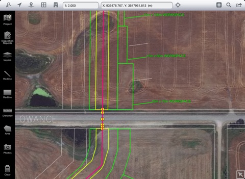
- It shows area map in multiple layers, which can be turned on and off;
- Documents of different format (PDF, Image, Text, etc.) are supported to be viewed geographically, i.e. associated with map locations or map objects of points / lines / polygons.
- Documents and map layers are grouped in projects of a company.
- Different user can have different accesses to different projects.
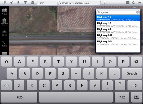
- Documents can be searched with spatial search, line cross search or area search.
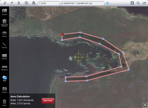
- Measure tools are available for calculating distance and area.
- On-screen locating tools are available for locating by a cords, legal description.
- Project data of layers or reports are stored on a FTP server.
- File changes can be detected and updated from local iPad.